The Pocomoke City Planning and Zoning Commission approved plans for a proposed 18-unit senior living development on 6th Street and Bank Street and moved forward with a separate four-lot residential subdivision along Cedar Street during its September 23 meeting.
The senior housing project, proposed for Tax Map 400, Parcels 315, 316 and 317, involves the redevelopment of the property at the intersection of 6th Street and Bank Street adjacent to the Pocomoke Car Wash. The commission reviewed both a Planned Redevelopment District (PRD) application and the associated master development/site plan.
According to city staff, the project calls for 18 residential units in three buildings. One building would contain six units along with an office and community space, while the other two buildings would contain eight and four units respectively. The proposed units are intended to be wheelchair accessible.
The development would include 24 parking spaces, including two handicapped spaces and an emergency vehicle space. It would also include sidewalks along the site’s street frontage as well as internal sidewalks.
Staff said approximately 48.73% of the property would remain open space, compared with a 25% minimum under the applicable code. The largest proposed building would be approximately 137 feet long, below the 200-foot maximum referenced by staff.
During the discussion, commissioners asked about the project’s second entrance on Bank Street, emergency vehicle access, parking and the size and configuration of the proposed units.
The applicants explained that the Bank Street entrance was positioned away from the intersection in an effort to address traffic concerns. The project would have entrances on both 6th Street and Bank Street.
The applicants also described a multipurpose area that would provide central laundry facilities, storage and community space. Each unit is expected to have approximately 3-by-5-foot storage space, while the common area could be used for resident activities and gatherings.
The project is intended for residents 55 and older. During the discussion, the applicants and city staff also discussed the need for senior housing in the community, including a waiting list for existing senior housing.
The commission ultimately approved the PRD and master development plan in a combined motion. It then separately approved the submitted site plan. The site-plan motion passed with the commission voting in favor and no opposition recorded in the transcript.
City staff explained that combining the PRD and master development plan review with the already-developed site plan would eliminate an additional round of review. Staff said the PRD process is generally intended for larger or more complicated developments where additional studies, such as traffic or parking studies, may be necessary. In this case, staff determined the site plan was sufficiently developed to allow the reviews to proceed concurrently.
Asked when construction could begin, the applicant said the goal was to “be in the dirt next year,” while noting that financing still needed to be worked through.
Cedar Street subdivision advances
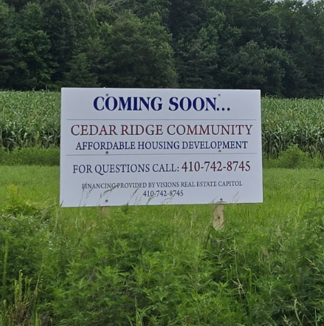
The commission also reviewed a boundary line adjustment and subdivision known as the Cedar Ridge Community involving Visions International LLC on Tax Map 402, Parcel 1515, located across from Newtowne Apartments between 12th and 14th Street.
The proposal creates two new lots and two revised lots for single-family dwellings, while also eliminating a boundary line in the rear of the property to create a larger parcel of approximately 25.10 acres.
City staff said the Planning Commission had previously reviewed the plat in 2023 and 2025, but consideration had been delayed while the county’s forest conservation requirements were addressed. Staff reported that Worcester County approved the forest conservation plan and subdivision plat in February 2026, with the county’s director of environmental programs signing the documents.
The four lots along Cedar Street are the portion of the project currently before the commission. Staff emphasized that any future development of the larger rear parcel would require a separate review by the Planning Commission.
The property would also include a 60-foot right-of-way to the rear property and a 15-foot utility easement along Cedar Street. An existing sidewalk along Cedar Street would remain.
Water and wastewater capacity became a significant part of the discussion. Staff said the city’s wastewater treatment system has capacity to serve the four proposed lots, but raised the possibility that existing lift station or pump station equipment could prove inadequate when the homes are connected.
After discussion, commissioners clarified that the city was not saying the existing system was currently inadequate for the four homes. Rather, they wanted to ensure that if additional equipment ultimately proved necessary, the city would not be responsible for those costs.
The commission ultimately approved the boundary line adjustment without attaching the proposed equipment-cost condition to that motion. The condition was instead incorporated into the subsequent subdivision approval.
The subdivision was approved with a condition that any lift station or pump upgrades needed to serve the four lots would be handled at the developer’s expense.
Stormwater and potential flooding along Cedar Street were also discussed. City staff asked commissioners whether they had experienced regular nuisance flooding in the area.
Commissioners said they had not experienced regular flooding on Cedar Street. A local engineer involved with the project said the area around the intersection of Cedar Street and 14th Street had historically experienced flooding, but said he had not observed the same problem at the proposed development site.
The engineer explained that the four proposed homes would be positioned toward the front of the lots, with grading intended to allow water to dissipate into the ground. If grading during site work indicated that water would instead be directed toward the street, the developer could redirect drainage toward the rear of the properties.
Staff noted that if the developer eventually seeks to develop the larger rear parcel, stormwater engineering of the existing ditch and surrounding area would likely need to be considered at that time.
Other business
During commissioner comments, the commission discussed a recently constructed single-family home on 6th Street (Collins Property) and whether required site improvements, including a sidewalk, had been completed. Staff said the matter could be followed up separately.
Commissioners also briefly discussed the ongoing redevelopment of the Newberry Building, noting that work on the building’s large roof was continuing. One staff member said there had been significant activity at the site and that flashing and other roofing work could now be seen.
The commission then returned to an earlier agenda item and approved the May 28, 2026 Planning and Zoning Commission minutes after confirming that enough commissioners who had attended that meeting were present to establish a quorum. Two members abstained from that vote.

